A CAMINO JOURNAL · GALICIA
From Baionato Redondela.
Bridges with stories to tell. Manor houses among the trees. The Atlantic, always nearby. Explore the places that make this stretch of the Camino special.
5 areas · 20 stops · Camino Portugués por la Costa


Follow the line. Discover the way.
Chapter 01
Baiona
Historic centre. The Camino crosses the town and leaves along Rúa do Conde.

- 01
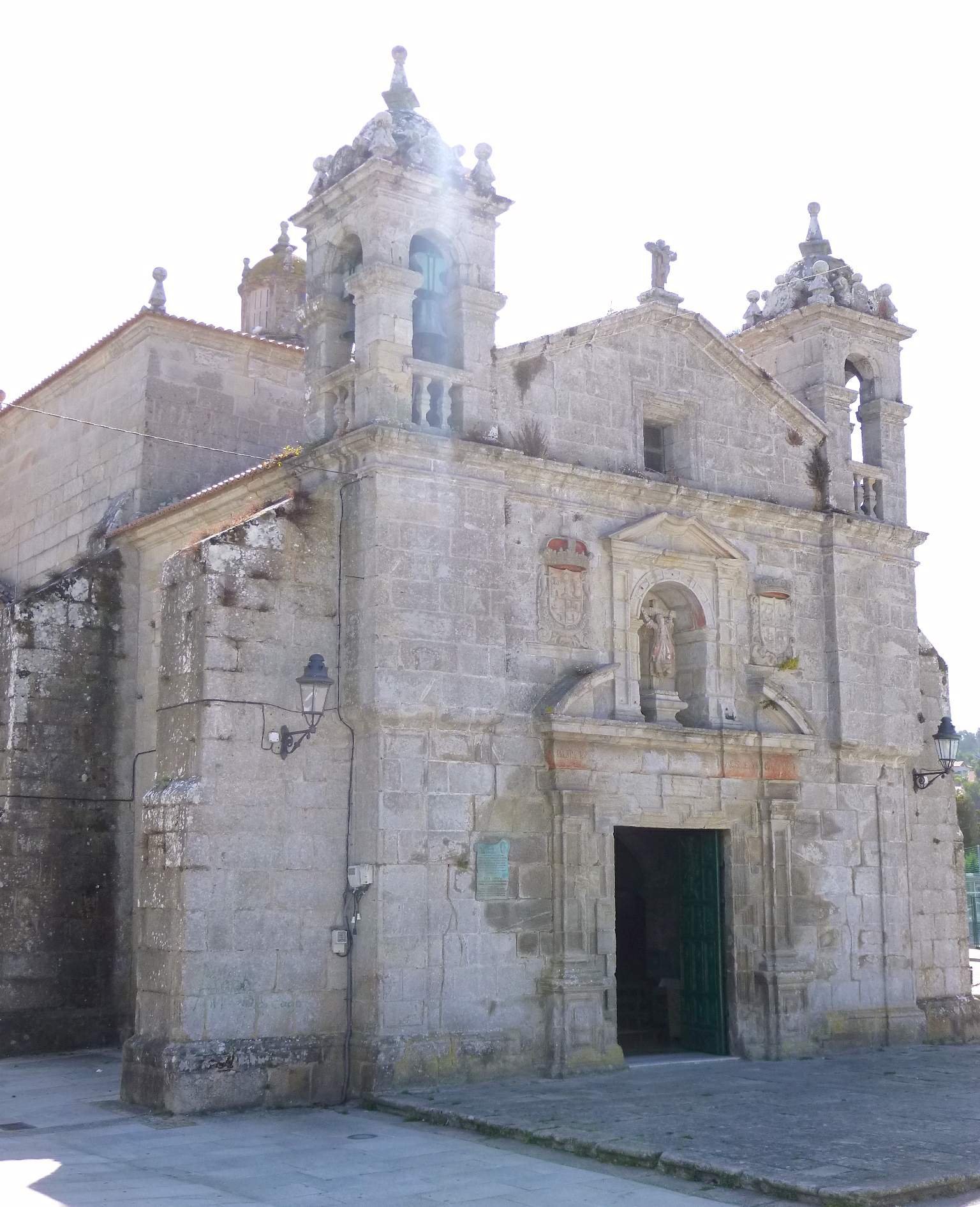
Chapel of Santa Liberata
It stands in old Baiona, a few steps from Rúa do Conde, where the Portuguese Coastal Way leaves town for A Ramallosa. Look up before you go: the twin towers are visible from the street.
History and details
Built between 1695 and 1709 by popular subscription. Between its two towers, a niche holds the crucified saint, flanked by the coats of arms of the Kingdom of Galicia and the town. Inside is a relic, an arm bone, brought from Sigüenza in 1689. Her feast day is 20 July.
Explore this stop ↗ - 02
Sancti Spiritus Hospital
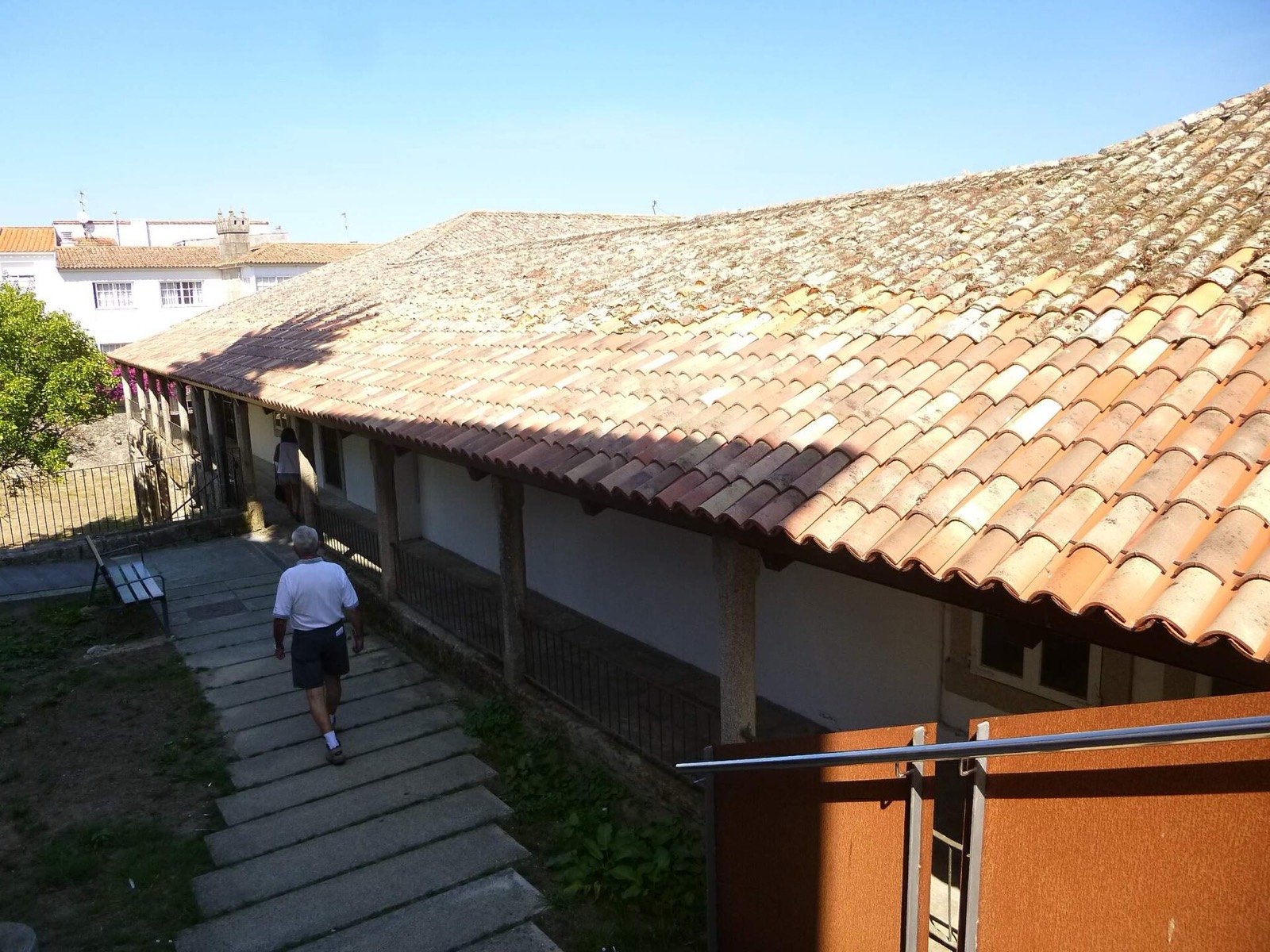
It sits in the centre of Baiona, on the same urban stretch as Santa Liberata. The granite arcade and tiled roof are what remain of the days when pilgrims were taken in here.
History and details
A 15th-century pilgrims' hospital, one of the oldest on this coast. It is now the town's cultural centre, but the façade still carries the “Hospital de Caridad” plaque and the medallion of the Holy Spirit that gave it its name.
Explore this stop ↗ - 03
Fonte do Pombal
It is not in the main square: look for it as you leave Baiona towards A Ramallosa, hard against the old Camino Real. The spout still runs.
History and details
A fountain-well of around 1560, Gothic in outline, set under an arch in the wall of the Casa de Cristo Rei at O Cruceiro Novo (Santa Cristina da Ramallosa). Three coats of arms sit on the front: the 16th-century royal arms, those of Baiona, and a third now worn smooth. Behind it is a three-metre wash-place. The official Camino guide puts it 1.8 km from the town centre, on the old Camino Real.
Explore this stop ↗
Chapter 02
A Ramallosa
The crossing of the river Miñor: the boundary between Baiona and Nigrán, where the marshland begins.

- 04
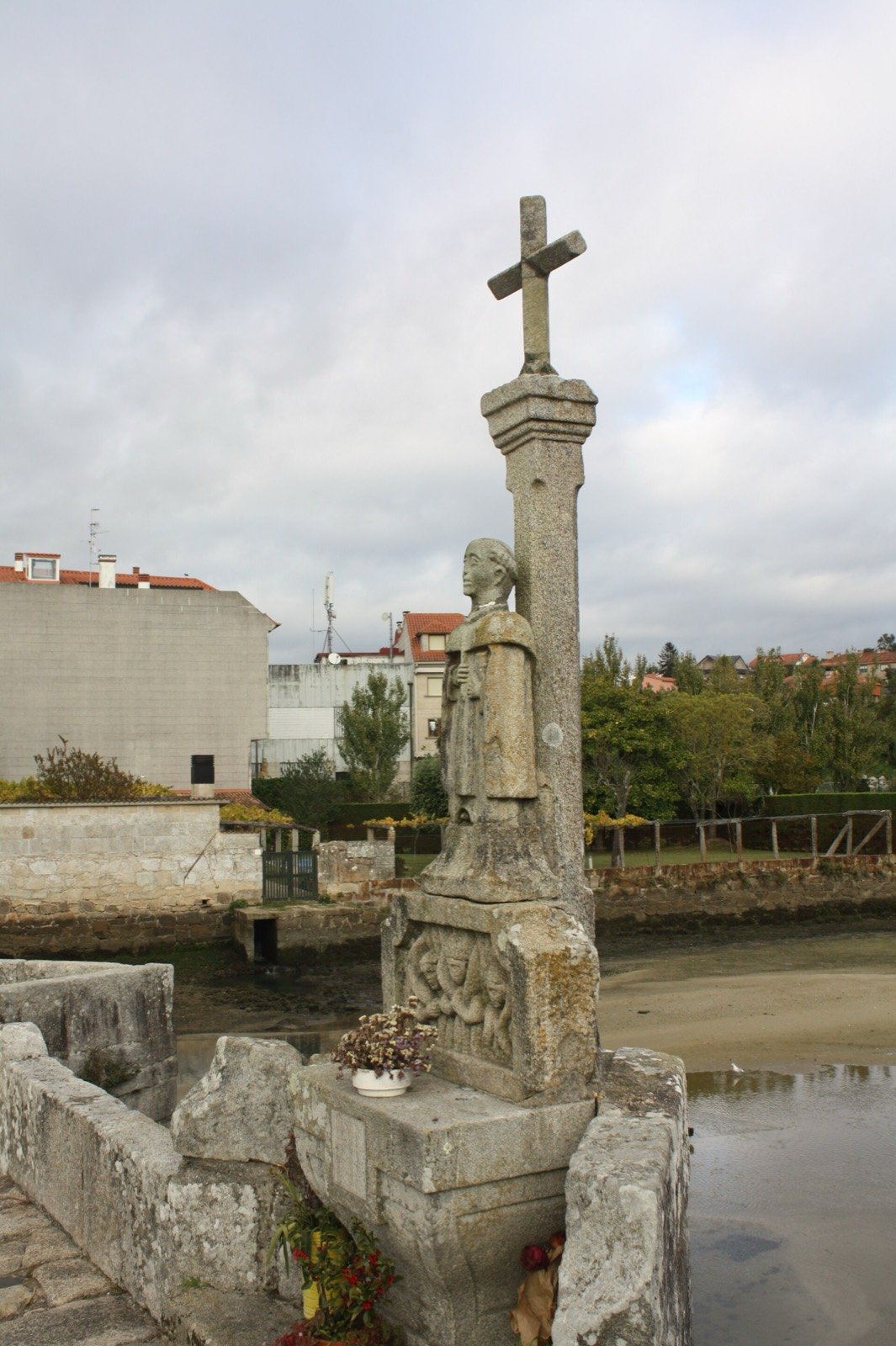
Cruceiro of A Ramallosa
You cannot miss it: the cross stands in the middle of the bridge. For anyone coming from Baiona it marks the moment you enter Nigrán.
History and details
Standing halfway across the bridge, with its souls' shrine and an image of San Telmo, patron of sailors. Tradition holds that he ordered the bridge rebuilt on the spot where he had worked a miracle. At its foot, a stone table once used in fertility rites.
Explore this stop ↗ - 05
A Ramallosa Bridge
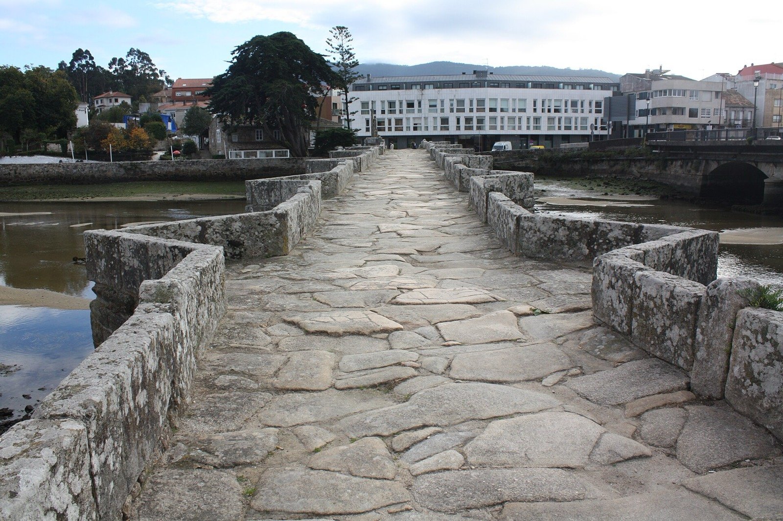
Ten arches and ninety metres. The Camino enters Nigrán on this deck, not on the modern road bridge beside it. At the northern end, Villaverde’s scallop shell confirms you are on the way.
History and details
Ninety metres and ten granite arches over the river Miñor. Late Romanesque, 13th century, rebuilt around 1232 while San Telmo was bishop of Tui, probably on the Roman road XX Per loca maritima. Pilgrims still enter Nigrán this way, as they always have. At the northern end, a scallop shell carved by local sculptor José Antonio Villaverde.
Explore this stop ↗ - 06Details to be confirmed
Former pilgrims' hospital
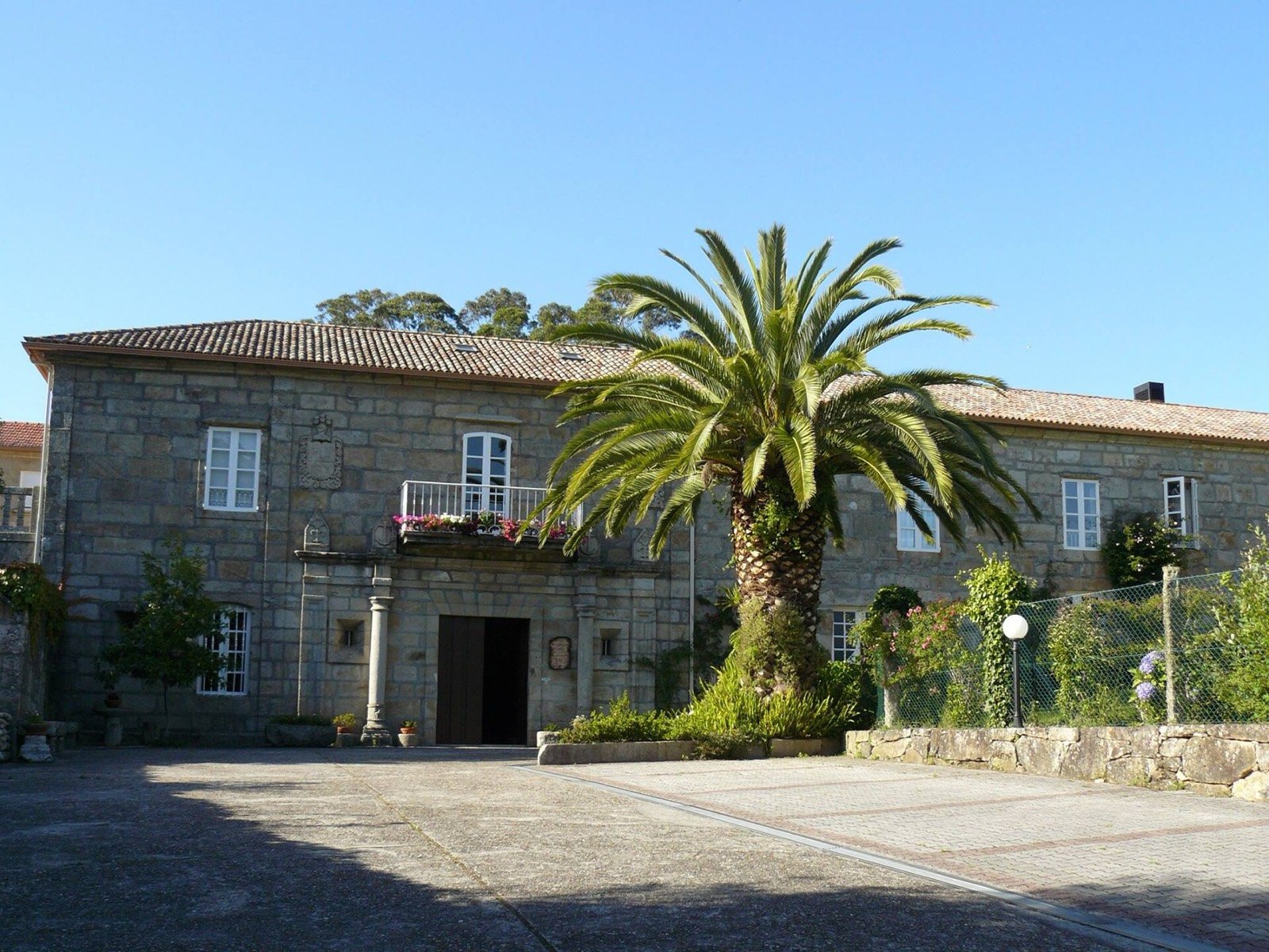
Four hundred metres beyond the bridge, already in Nigrán. If you need a bed before Priegue, the pazo guesthouse still keeps rooms for pilgrims.
History and details
For centuries the Miñor crossing was where those walking to Santiago were taken in. That role lives on four hundred metres beyond the bridge, at the 17th-century Pazo de As Pías guesthouse, which still keeps rooms for pilgrims.
Explore this stop ↗ - 07
Sculpture of the pilgrim woman
On the Alameda in A Ramallosa, just after the bridge. A good place to sit for a minute and look out over the estuary before walking on towards Mallón.
History and details
A 2.3-metre bronze on the Alameda by José Molares, a local resident and the sculptor of Vigo's Jules Verne. It shows a woman pilgrim mid-journey, with staff and rucksack. A plaque at her feet invites you to stop and look out over the Foz do Miñor, and to remember that the Camino is also walked inwardly.
Explore this stop ↗
Chapter 03
Nigrán and Priegue
Manor houses, stone crosses and the climb up Monte Sanromán, the last serious ascent before Vigo. This is where we are.

- 08
Cruceiro de Mallón
Between A Ramallosa and the manor houses. The cross marks the way through Mallón, among stone walls and granaries, before you reach Urzáiz.
History and details
One of the two stone crosses singled out by the official Camino guide on the way through Nigrán, along with O Pereiro. It marks the route among granaries, stone walls and vernacular architecture.
Explore this stop ↗ - 09
Pazo de Urzáiz
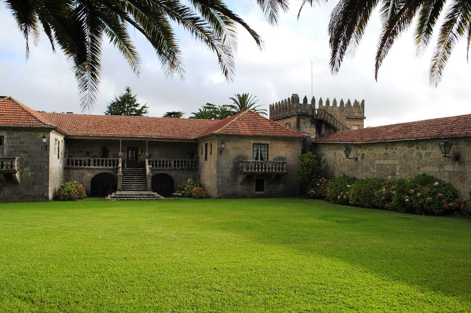
You see it from the Camino: battlemented tower and a stair down to the garden. It is not a drop-in visit: just recognise it as you pass. Listed since 2006.
History and details
Also known as the Pazo de Cadaval, one of the finest in the province. It already stood in the 14th century and has been a listed monument since 2006. Coats of arms of the Cadaval, Figueroa, Ozores, Montenegro, Ceta, Correa and Urzaiz families are set around the house.
Explore this stop ↗ - 10
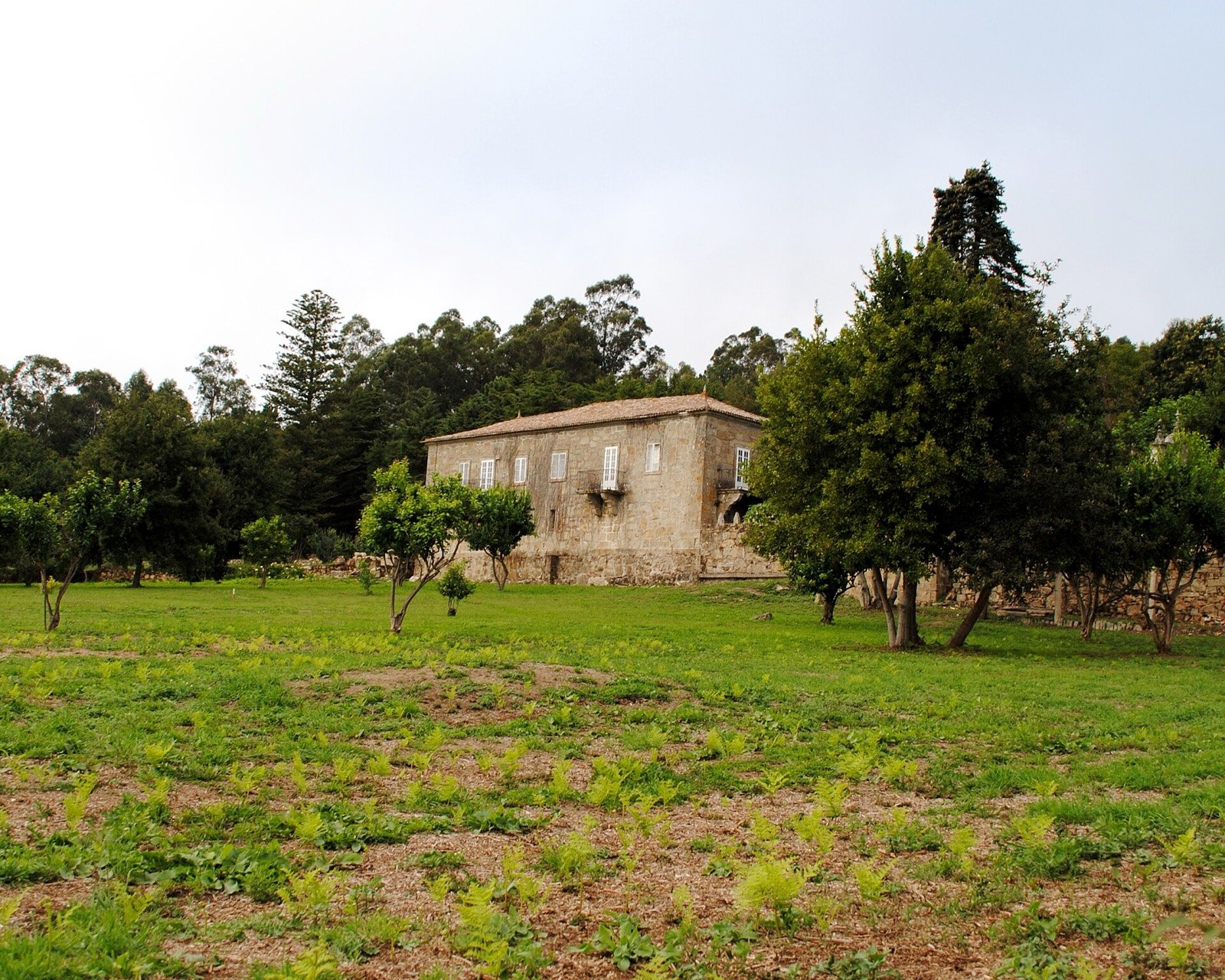
Pazo de Cea
The last manor on the flat stretch. From here the Camino climbs towards Monte Sanromán; if you want food, Berratola is a little further on, in Priegue.
History and details
Sixteenth century and also a listed monument, with its own gateway and chapel. Together with Urzáiz it closes the flat stretch: from here the climb to Sanromán begins.
Explore this stop ↗ - 11
Cruceiro do Pereiro
Already around Priegue, with the hill at your back. It is the second cross named by the Xunta’s guide in Nigrán, after Mallón.
History and details
The second cross highlighted by the official guide in Nigrán, already close to Priegue with the hillside behind you.
Explore this stop ↗ - 12
Paco's Bench
In Priegue, a little before you reach us. Fruit, a bench, a stamp for your credencial and a notebook. It is not in the old guidebooks: a neighbour built it. If you pass early, leave it as you found it.
History and details
Paco Alonso, a neighbour in Priegue, began by leaving out a basket of fruit from his land for people passing by. When he saw them sitting on the ground to eat it, he put up a bench. Today there is a table, a bin, signs counting down the kilometres to Santiago, a visitors' notebook, he's on the third, and a stamp for your credencial, a gift from five Catalan pilgrims. It's the most photographed stop on this stretch.
Explore this stop ↗ - 13
YOUR CAMINO BREAK
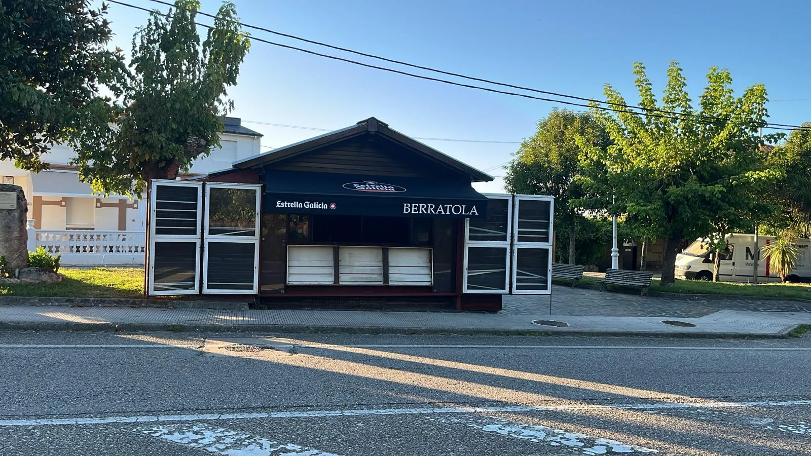
Berratola
Browse the menu, choose your collection time and refuel in Priegue.
- 14Details to be confirmed
Chapel of San Pío
If you ask for Berratola, this is the landmark: the chapel opposite. It is not in the guidebooks, which is why locals use it to give directions.
History and details
Directly opposite our door. A neighbourhood chapel of the kind that punctuates the Camino without appearing in any guidebook, and the landmark we give when people ask where to find us.
Explore this stop ↗ - 15Details to be confirmed
Cruceiro das Rexas
On the way out of Priegue towards the Vigo boundary. If you see it, Berratola is already behind you: the path then drops towards Samil.
History and details
Another granite cross at the roadside, on the way out of Priegue towards the Vigo boundary.
Explore this stop ↗ - 16Details to be confirmed
Fonte do Peregrino
Right on the path, already leaving Priegue. The last easy water before the urban stretch into Vigo: fill up here if you did not do so at Berratola.
History and details
A fountain right on the route, the kind that has been slaking walkers' thirst for centuries. A good place to fill up before the urban stretch.
Explore this stop ↗
Chapter 04
Vigo
The Camino drops down to the sea at Samil and enters the largest city in Galicia.

- 17
Carreiro dos Muíños
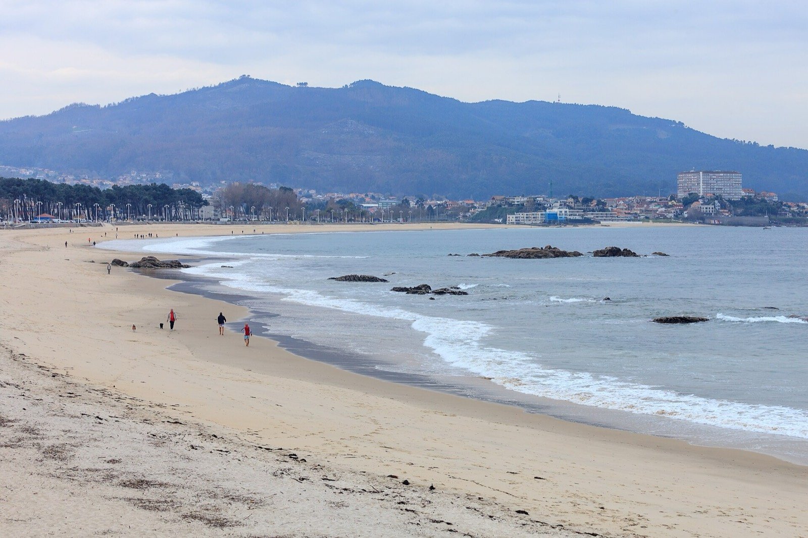
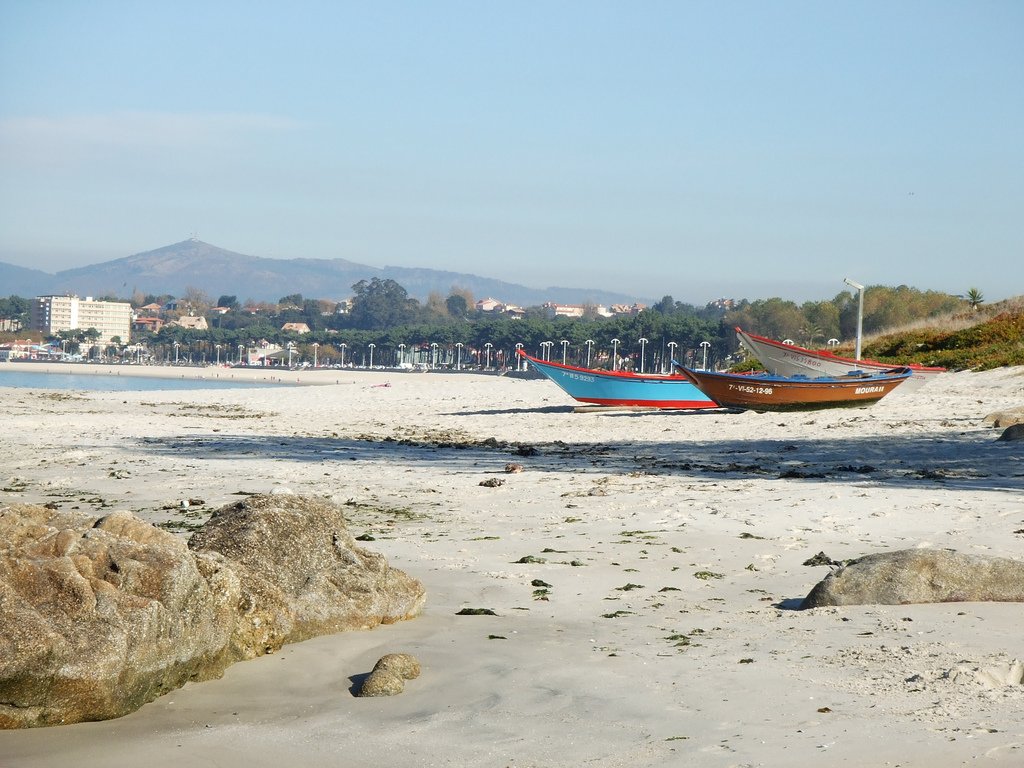
The drop to Samil is Vigo’s front porch. From the beach, take the Lagares walkway up: it keeps you off the road and into Coruxo with less tarmac.
History and details
The millers' path drops down to Samil beach, Vigo's front porch, with the Cíes islands on the horizon. From there the best way into the city is to follow the Lagares river walkway upstream rather than fight the traffic.
Explore this stop ↗ - 18
Church of San Salvador de Coruxo
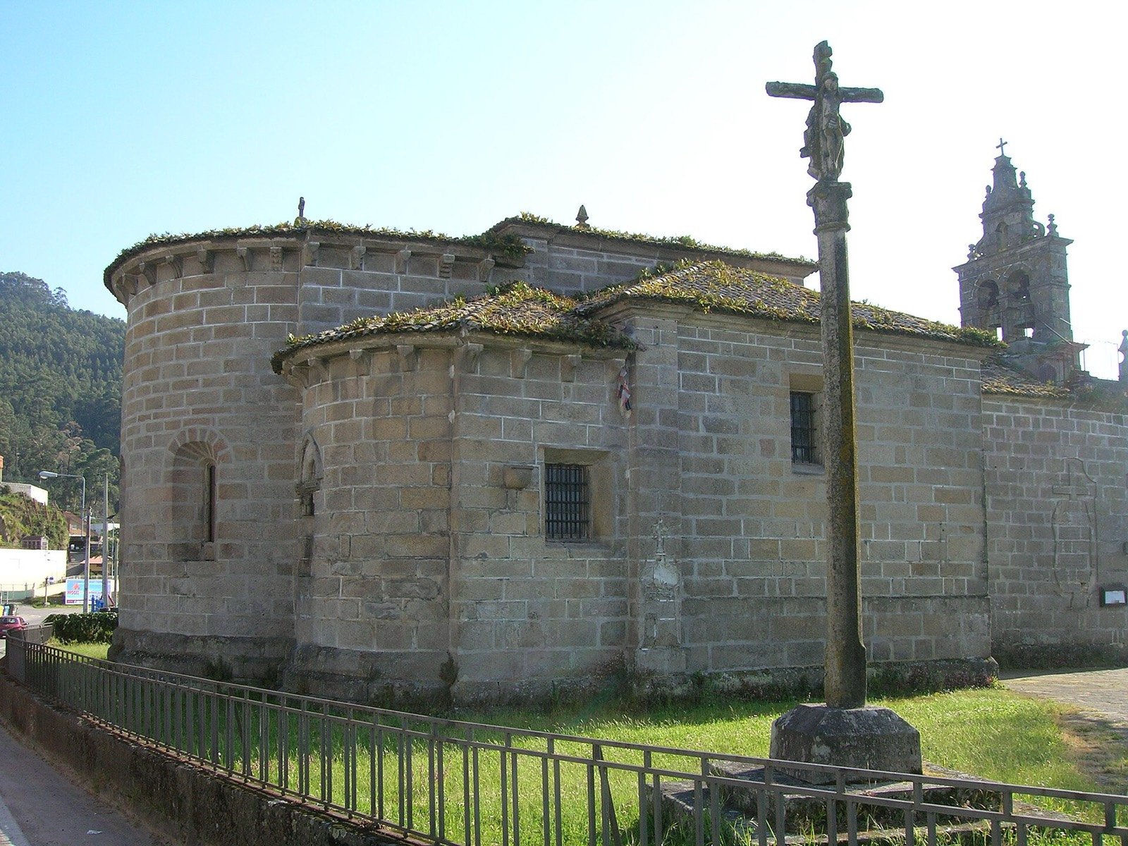
After Samil the Camino goes right past it. The three apses are visible from the churchyard; the 1641 cruceiro stands in front. It is the Romanesque stop of the stage before the city centre.
History and details
A 12th-century church, a Benedictine monastery under Celanova until the 14th century and a parish church ever since. Its three semicircular Romanesque apses survive, along with figured capitals and the original corbels: with Castrelos and Bembrive, it is one of the three finest Romanesque churches in Vigo. Beside it stand a cruceiro and an old fountain.
Explore this stop ↗ - 19
Co-cathedral of Santa María
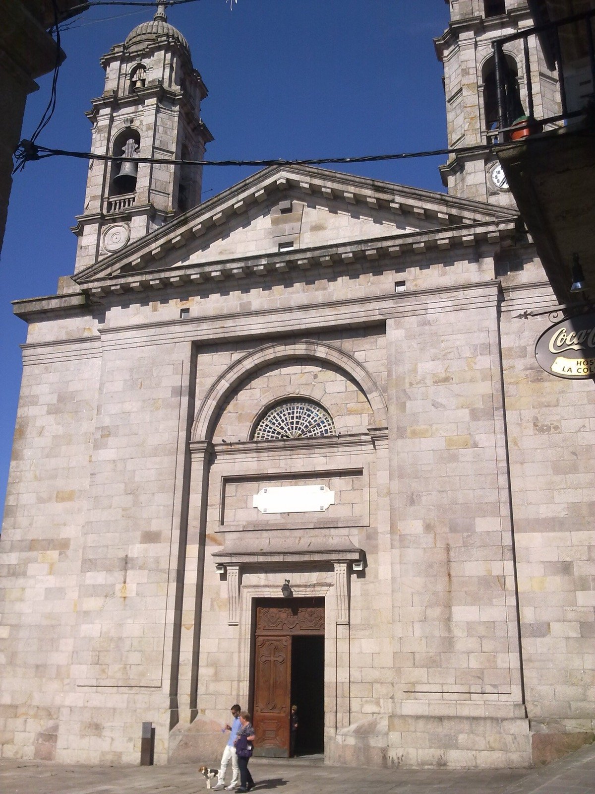
In the old centre of Vigo, on Praza da Igrexa. The urban Camino runs past it. If you stamp your credencial in the city, it is usually here or at the hostel.
History and details
The Colexiata, which shares the seat of the diocese with Tui cathedral. Its predecessor was wrecked when a powder magazine at O Castro exploded in 1809; Melchor de Prado signed off the new design in 1811 and it was built between 1816 and 1838. It is the finest neoclassical building in Galicia, its two baroque towers the only concession. Inside is the Cristo da Vitoria.
Explore this stop ↗
Chapter 05
Redondela
Where the coastal route joins the inland Portuguese Way.

- 20
Church of Santiago de Redondela
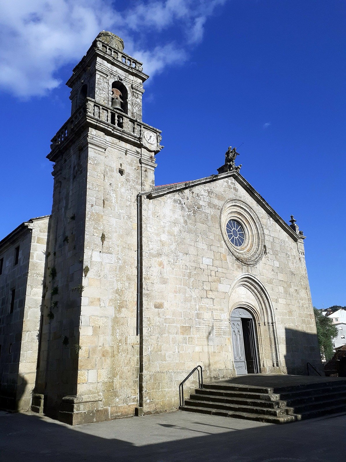
At the top of the old town. This is where the coastal route, ours, meets the inland Portuguese Way. From Redondela there is one path on to Pontevedra.
History and details
Consecrated by Archbishop Xelmírez in 1114, though almost nothing of the original Romanesque church remains: what you see is 15th and 16th century, with the baroque tower added in 1712. It stands at the highest point of the old town, with a plain façade, a rose window and a Santiago Matamouros above. Its dedication to the Apostle is no accident: this is where the two branches of the Portuguese Way meet.
Explore this stop ↗
The journey continues.
And when you pass through Priegue, you have a place to stop.